Getting Greener?
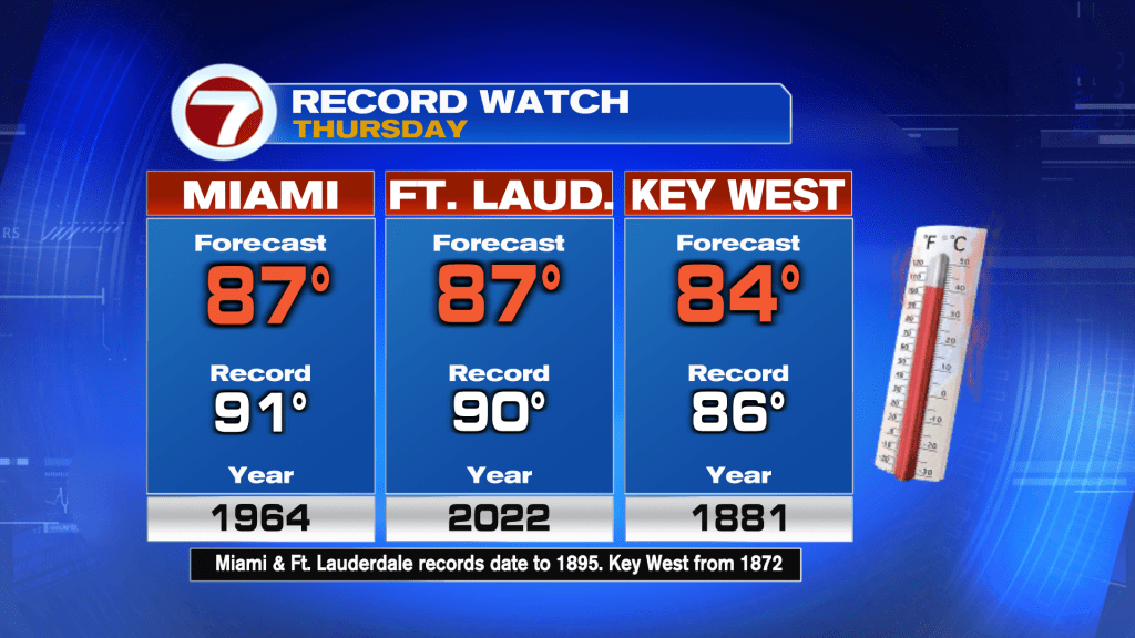
The grass may soon look greener, south Florida. That’s rare. The lack of rain (and ongoing drought) have had us waiting anxiously for rain opportunities. The potential increases at the end of the week and doesn’t stop there! Before that happens, though, we’ll have a push of warmer air and higher humidity on Thursday. While we’ll probably stop short of records in Miami and Ft. Lauderdale, we could come close to record highs in the Lower Florida Keys (Key West). Here’s a check on the numbers.

The added “spring” in temperature is due to winds turning out of the southwest. While it’s not officially the spring season for over a week, it will definitely feel spring-like and actually more typical of May, than March.
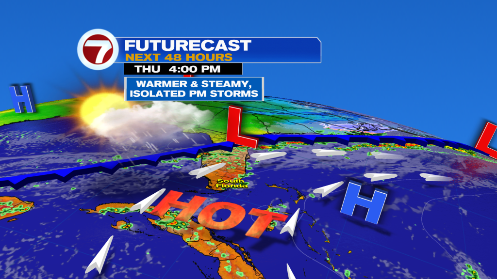
This is the Thursday weather map showing the progression of hotter air expanding out of the tropics. To our north? A weakening Front will enter north and central Florida so we’ll initially be on the steamy side of it. There may be a few afternoon showers popping during the afternoon, but they’ll be isolated to scattered.
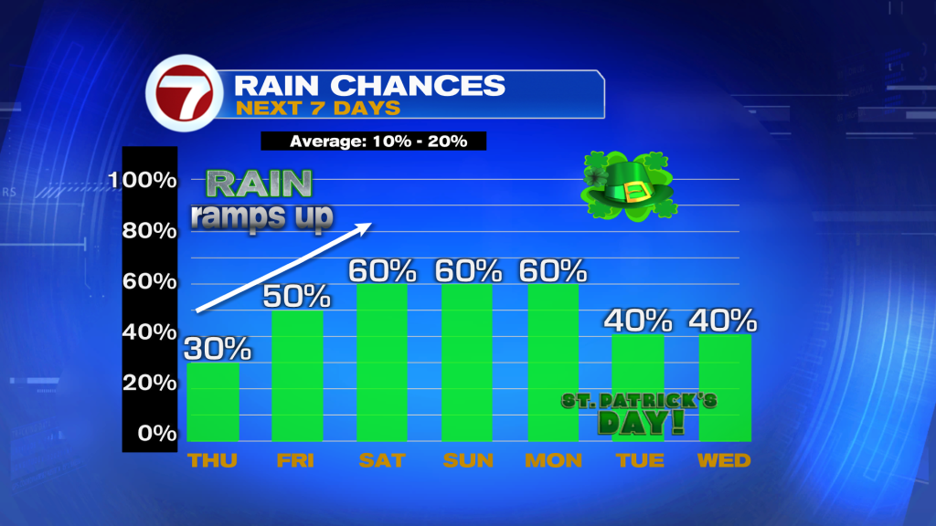
Rain chances increase on Friday, and beyond. Forecast models show the “weakening remains” of the Front falling apart this weekend. After that, the chance for wet weather continues due to a pool of moisture holding over the region.
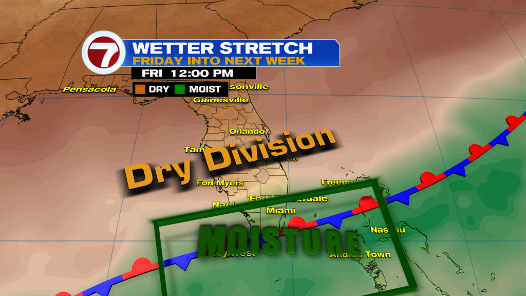
On the Friday map (above) you can see the stalling, fading front draped over the area. You’ll also see the division of drier air to our north.
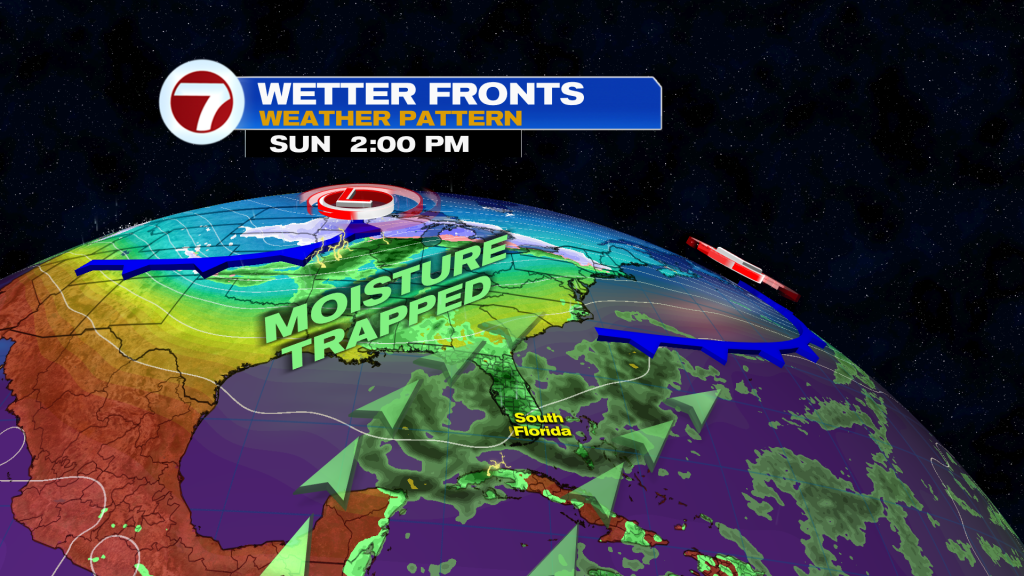
The upcoming weekend will feature times of showers, especially as the moisture plume expands north (later in the weekend). Then, we’ll simply wait for another front. It’s forecast to move southward, gradually working our way into early next week. By the look of things, St. Patrick’s Day could be damp (Tuesday) as this secondary Front pushes along.


