WINDY START TO THE HOLIDAY WEEK
Happy Monday, December 22, 2025, South Florida!
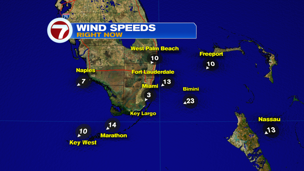
Hopefully everyone had a great weekend! The holidays are almost upon us and now the final preparations and final shopping are here. And we’re hoping the weather cooperates! South Florida saw a pretty decent weekend as a weak front left very comfortable conditions on Saturday. Sunday temperatures were a bit more mild and we noticed a little more in the way of humidity. Not to mention that some areas in Broward County did see some shower activity during the Sunday afternoon hours. This morning there were showers concentrated across the Florida Keys while many other areas of South Florida remained quiet. With that said, our temperatures this morning were definitely much warmer than this past weekend due to the building breeze across the region. Most areas started the day off in the 70s.

More changes can be expected to the forecast today. We will notice a breeze building throughout the morning as a front remains stalled to the south of us and high pressure to the north of the area. Windy to gusty conditions will be possible throughout the day and those wind gusts could reach as high as 30 mph. South Florida rain chances will remain on the lower end as drier air spreads across the region. With that said, a strong breeze coming off the water usually drags in a few showers from time to time. Afternoon high temperatures will once again reach into the lower 80s, which is near average this time of year.

Looking ahead, South Florida weather will remain windy for a few days. After a weak front pushed through the area unnoticed this past weekend, a second front will quickly move across South Florida today into Tuesday. With the old front to our south, an area of high pressure nearby AND a second front on the move, the pressure gradient across the area will tighten. This will keep windy to gusty conditions across South Florida through at least the first half of the work week. As for the second front pushing through Florida, we will not see any temperature difference BUT it will bring a reinforcing shot of ‘nice weather’. A few quick-moving showers will be possible once again on Tuesday as the front moves through.

Behind the front, drier air will move in, which will help keep rain chances on the lower end for Christmas Eve, which is looking picture perfect across South Florida! Christmas Day is looking comfortably warm but a spotty shower will be possible, especially along coastal areas. Very nice conditions continue through much of the second half of the work week!

Have a great day!
Erika Delgado
Meteorologist
WSVN / ABC Miami