Warm today, rain and wind tomorrow
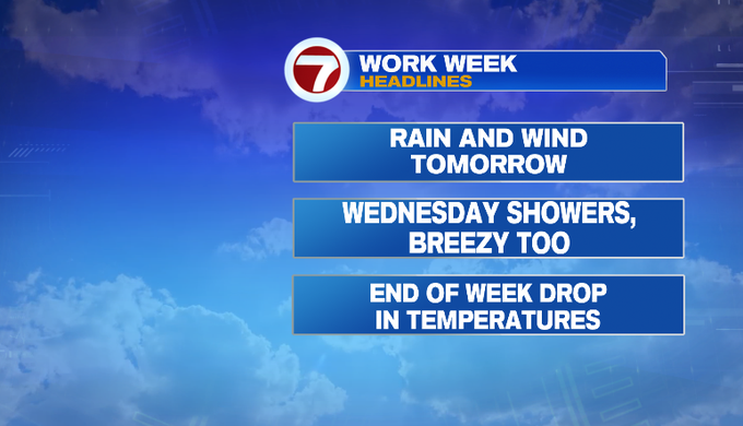
Good morning! We’ve had a nice and dry weekend. Rain returns to tomorrow. That’s just one round of two coming this week. It could turn unsettled at times late in the week.
Temperatures start off cool but rebound to warm highs in the upper 60s/near 70. We’ll see increasing clouds, and it’ll turn breezy. Enjoy it!

Changes are inbound tomorrow. A cold front brings heavy rain and gusty wind. It will impact our morning commute. The front is progressive, so the rain will wrap up by early afternoon.
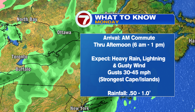
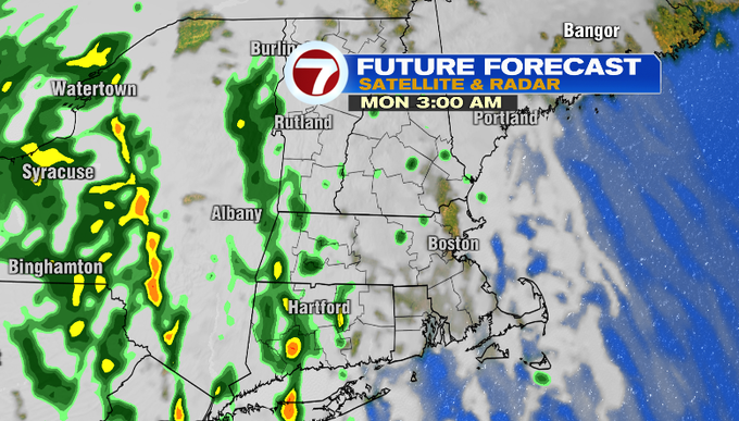
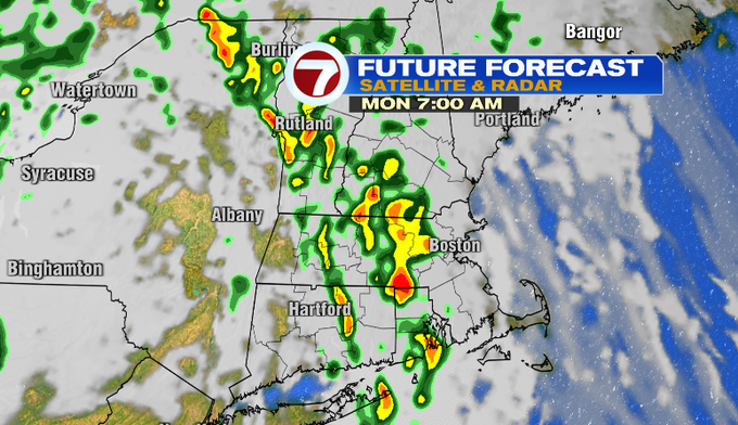
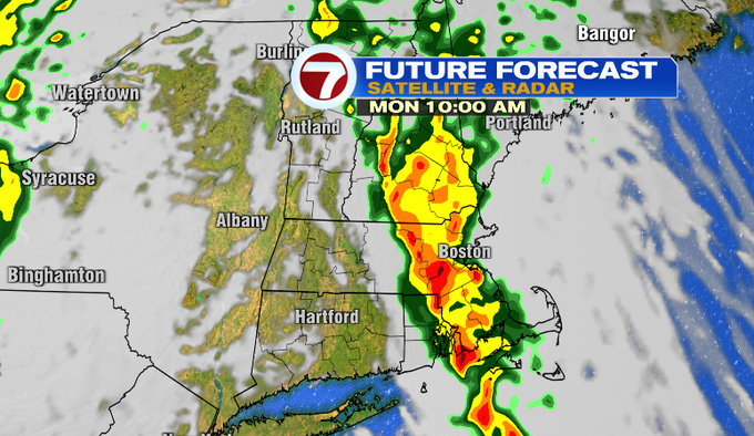
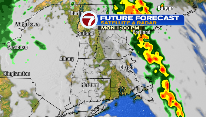
Here’s a closer look at the timing of the rain. Overnight, there will be a lot of clouds and some spotty showers developing. The main event arrives between around 6-7 am for Worcester County and parts of MetroWest. Plan on it being a messy and slow commute. The rain continues to fill in to the coast through the morning. It will be a wind-driven rain. The peak of the heavy rain by 10 am. The rain lifts northeast and offshore through the early afternoon. There will still be quite of bit of clouds with some breaks of sun the rest of tomorrow.
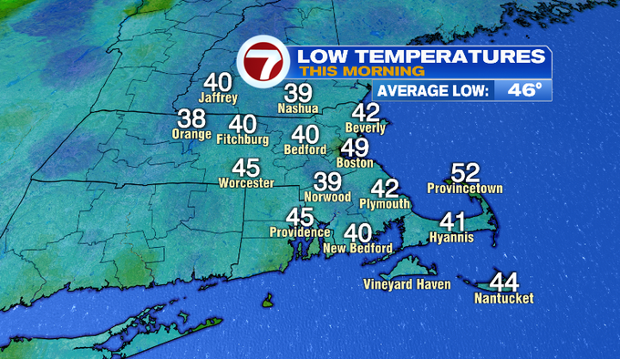
Temperatures start out in the 50s. Highs will likely be in the morning in the mid/upper 60s. Once the front passes, temperatures fall through the 50s.
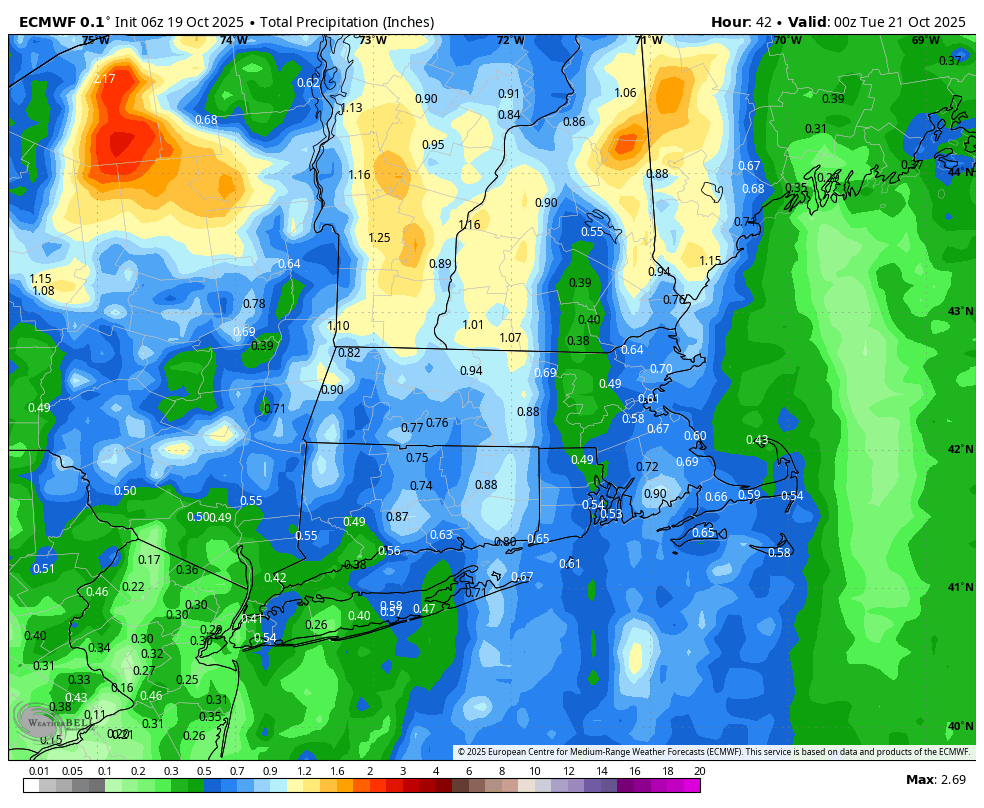
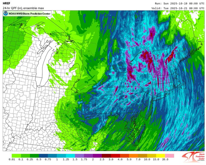
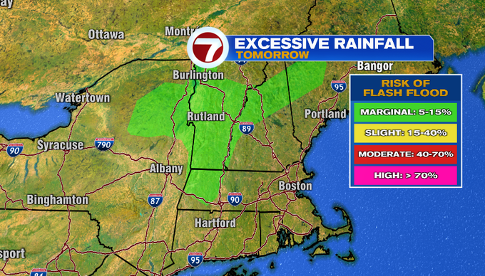
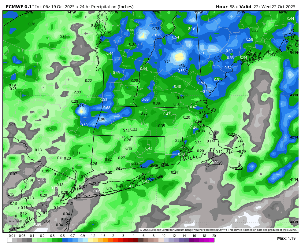
Most of us pick up around .50 -1″ of rainfall. However this is a scenario that could produce locally higher amounts especially under downpours. The greatest threat for excessive rainfall leading to flash flooding will be to our west and north.
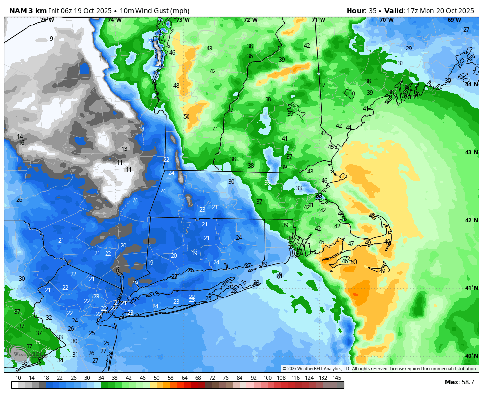
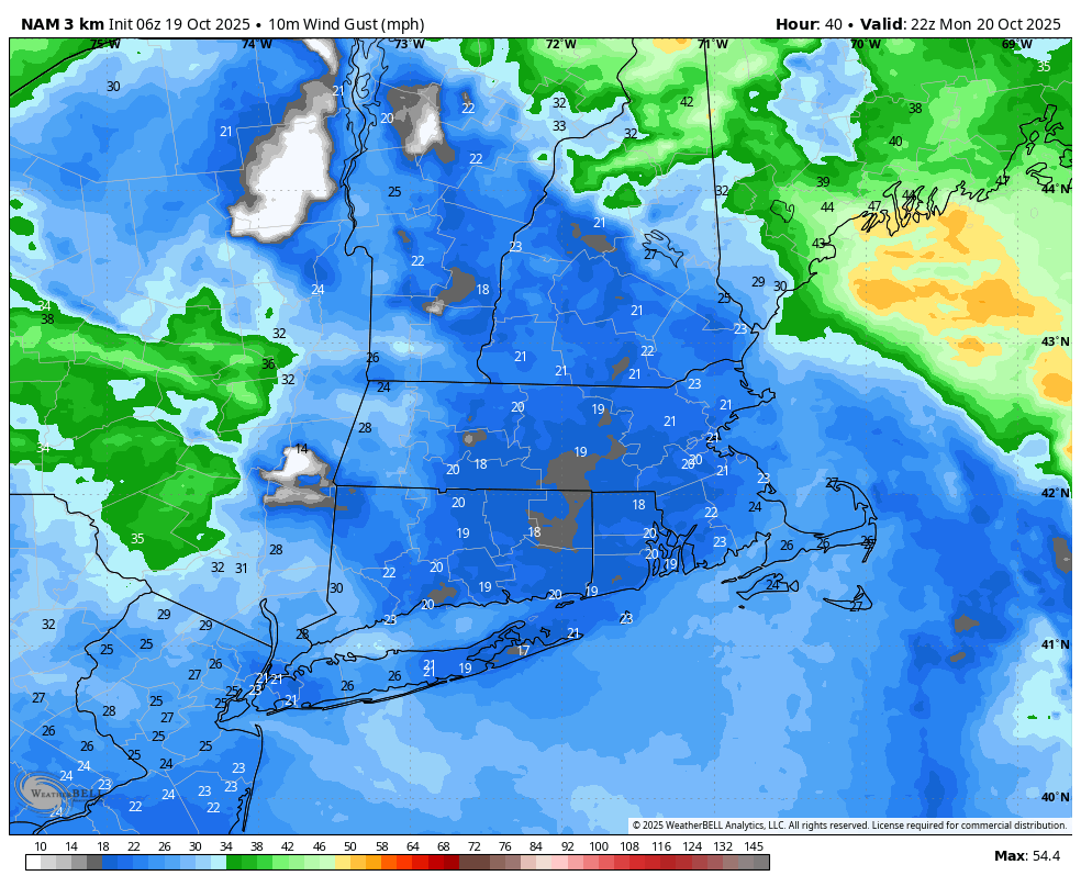
Today it’s breezy with winds gusting out of the south 20-25 mph. Take time today to secure your Halloween decorations or anything else you have outside. It stays breezy overnight. The peak of the wind will be tomorrow morning through early afternoon. Winds could gust 30-50 mph. The strongest wind will be across the Cape and Islands. It will still be breezy tomorrow evening.
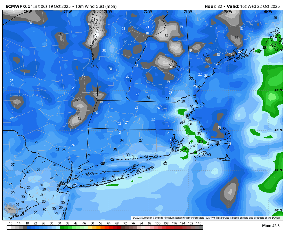
Another frontal system comes through Wednesday. This one appears weaker. Showers arrive for the morning commute and linger through the day. It will be breezy with winds gusting up to 35 mph.

We’ll stay under a trough with another cold front coming through Thursday to Friday. There’s a chance for a spot shower during that time. More noticeable will be the cooler air working in with highs in the upper 50s Friday and next Saturday.
-Meteorologist Melanie Black


