Warm and Overall Quiet Rest of Week

It’s been a nice and overall dry week so far and that trend will persist into the rest of this week, including this weekend.
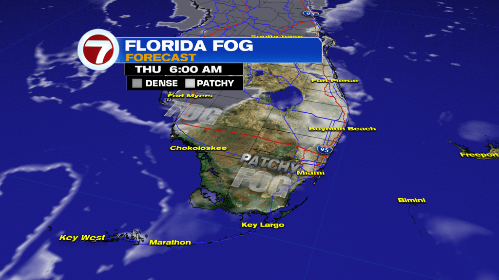
Another calm and quiet night is in store Wednesday night, which will allow for the potential for some patchy fog, especially farther inland and away from the metro. Otherwise, temperatures will be mild and above average with widespread lows in the mid to upper 60s.
Heading into Thursday, some minor changes will take shape as high pressure currently on top of Florida weakens and shifts toward the Atlantic Ocean while another area of high pressure strengthens near the northeastern US.
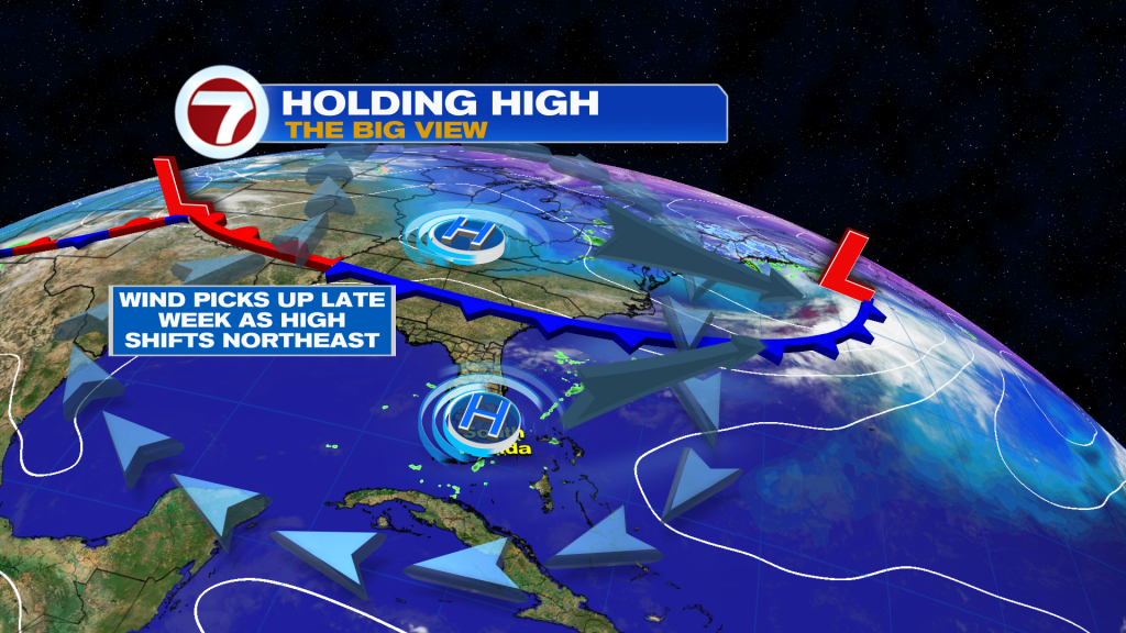
This subtle switch will usher in a building breeze, with breezy conditions forecast for Friday into Saturday.
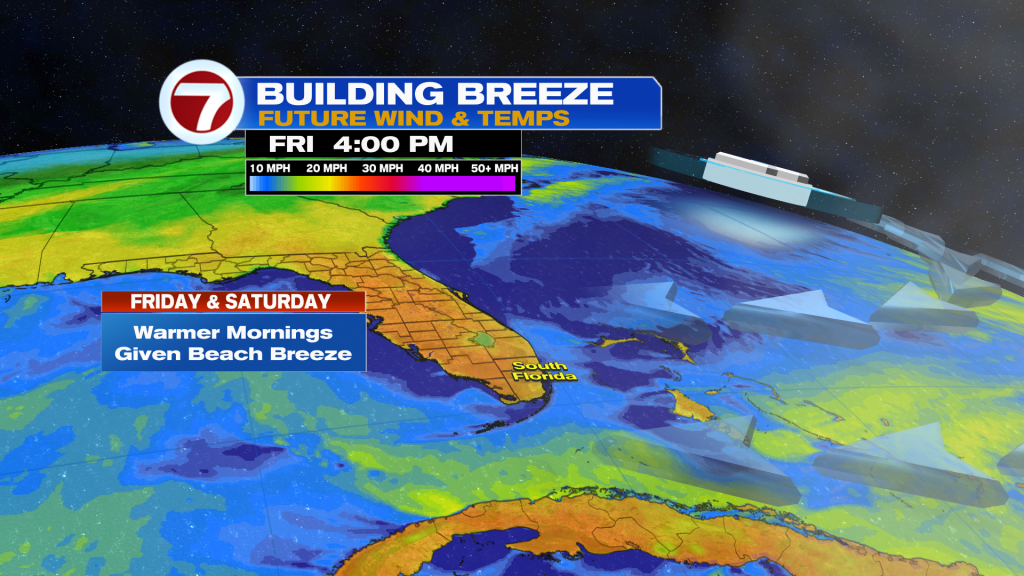
At least on Thursday, it will be a gradual increase in the breeze, which may draw in some spotty showers, especially during the first half of the day. Given that potential, expect sunshine but also some periods of cloudiness.
Then to wrap up the week and begin the weekend, it will be breezy, warm during the day, warmer overnight, bright and likely dry.
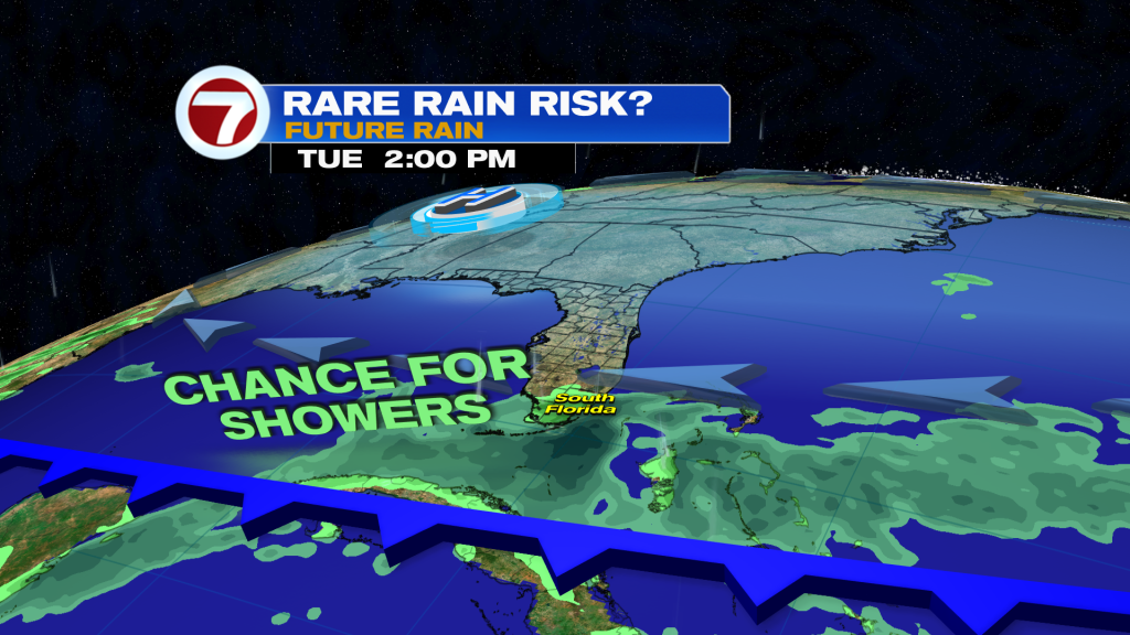
It’s not until Sunday when our next weather-changing feature approaches. That feature is a front but this one will be much weaker in comparison to last week’s chilly front that began the new year.
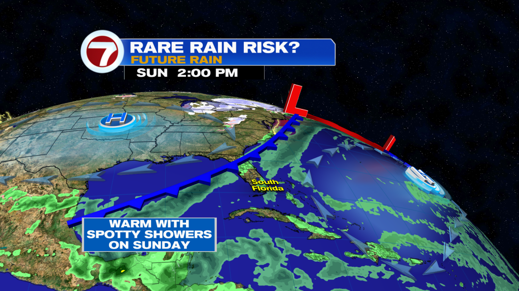
Sunday is poised to be a quiet day overall with low rain chances but temperatures should be a touch warmer courtesy of the lighter wind.
That wind then ramps back up early next week out of the northeast behind the front’s passage Sunday night. That wind direction will make for milder temperatures, especially during the day, but the cold will not be maximized given the onshore wind opposed to the cold, land air.
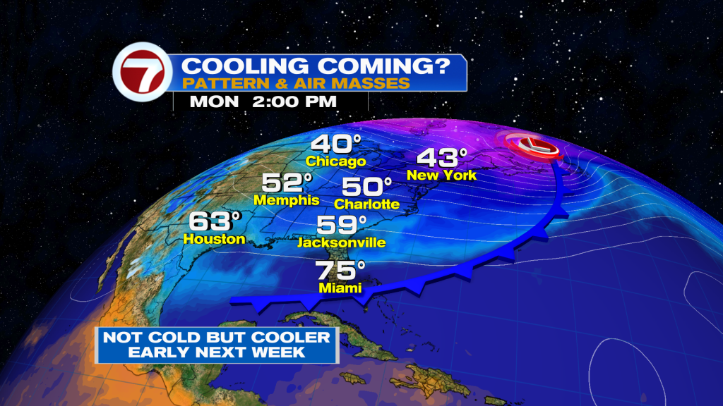
In addition to this minor drop in temperatures, this front could draw in higher rain chances starting mid next week so it’s something to potentially look forward to if you’re hoping for some needed rainfall!