Summer Heat Continues While Storm Chances Increase
South Florida will continue to experience a typical Summer weather pattern today, with warm temperatures, high humidity, and scattered afternoon storms.
The day will begin with a mix of sun and clouds and perhaps a few isolated coastal showers. By the afternoon, temperatures will climb into the upper 80’s and low 90’s, with heat index values near 100 degrees.
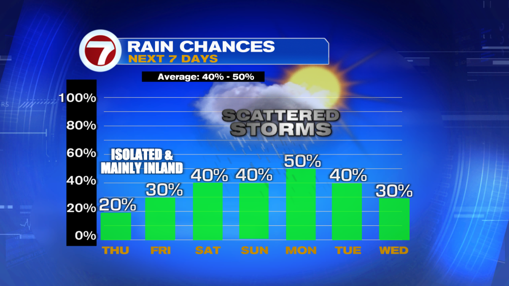
The highest chance for showers and storms will once again be across the interior, Alligator Alley, and Southwest Florida, while East coast metro areas remain less active. Most storms will produce brief heavy downpours, lightning, and gusty winds before fading during the evening hours.
Looking ahead, moisture levels will continue to increase Friday and through the weekend. As a result, rain chances will gradually rise across all of South Florida, with more areas seeing afternoon and early evening storms.
Heat and humidity will also remain elevated, with heat index values reaching 100 to 105 degrees through the weekend.

Today in the Tropics
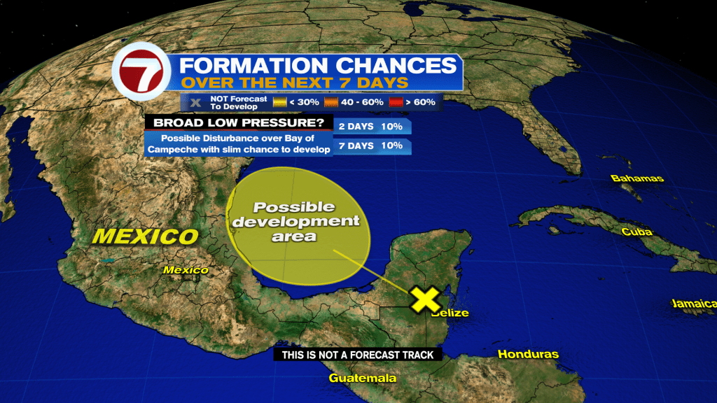
While no tropical development is expected to impact South Florida, forecasters continue to monitor a weak area of low pressure expected to develop in the Bay of Campeche. The National Hurricane Center gives it only a low 10 percent chance of development before it moves into eastern Mexico.
For now, expect another hot summer day with the greatest storm coverage focused west of the east coast metro areas.
Have a wonderful day South Florida and make if a safe one!
Vivian Gonzalez
Meteorologist, AMS Certified
WSVN Channel 7