Slightly milder weather ahead!
I don’t know who’s more excited– the folks celebrating the Pats send-off at Gillette or the folks looking at this forecast and realizing this storm is just going to brush by us!
If you were not ready for more snow, you really are in luck. The track of our coastal storm continues to trend east. We’ll see some intermittent snow showers along and east of I-95, though the heaviest snowfall may just be with a band of ocean-effect snow in Plymouth and Bristol Counties. The Cape and Islands also have the potential to see accumulating snow (up to about 3″). But areas west of 495 will be snowless, while areas between 495 and 95 will see a flurry or two. You get the picture– the snowfall will be lackluster overall.

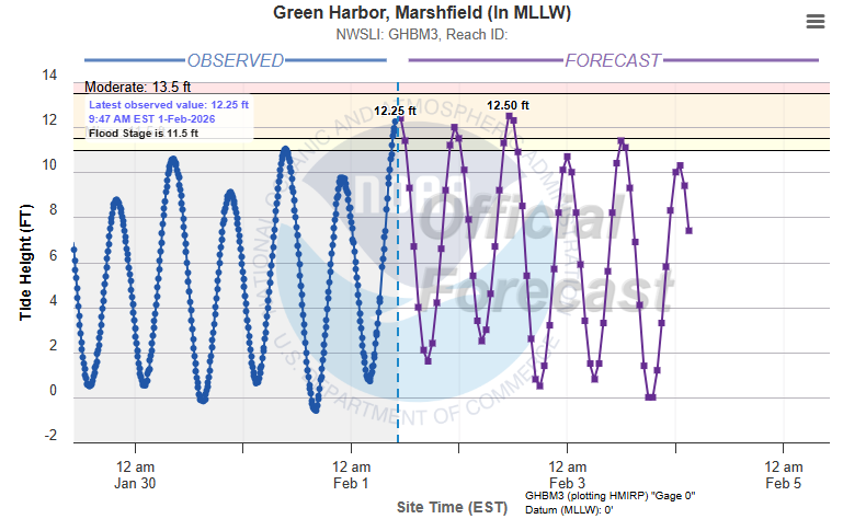
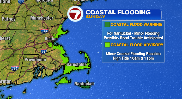
Other issues include minor coastal flooding and gusty winds. Coastal flooding will be an issue around high tide (11 PM) all along the Massachusetts coastline. This could be an issue for low-lying areas, like roadways and parking lots. Don’t drive over flooded roads! You don’t know the integrity of the roadway underneath that water, trying to find out isn’t worth the risk to your safety… or your car for that matter!

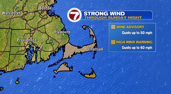
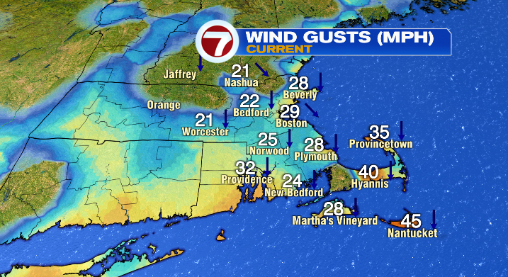
In terms of the wind, you can expect widespread gusts in the 20s with some intermittent 30s as well. The Cape and the Vineyard, however, could see gusts in the 40s, while Nantucket could see gusts up to 60 mph. For that reason, Nantucket has a High Wind Warning until Sunday night, while the Cape and Vineyard are in a Wind Advisory.
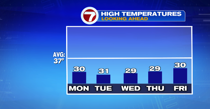
This storm is finally out of our hair tonight. Tomorrow (Monday), will be bright and mostly sunny. It’ll also be breezy, though not nearly as much so as Sunday. Highs will be right around 30 degrees, which is basically a heat wave at this point. Highs will stay more manageable for most of next week, mainly in the upper 20s and low 30s.
Toward the end of the week, we’ll be keeping an eye on two storms– one of which looks like it may just sweep past us. The second storm, clipper system coming out of Canada, could bring snow showers back into the forecast Friday and Saturday. We’ll keep you posted as we get through the week!