San Diego weather: Slightly cooler today ahead of heat and windy conditions mid-week
Foggy conditions along the coast and over our valleys have produced a little bit of drizzle this morning. The fog will stick around through this morning before mixing out heading into 11 a.m./noon.
It will be slightly cooler today thanks to a low-pressure system to our north, which is also bringing breezy onshore flow over our mountains and deserts.
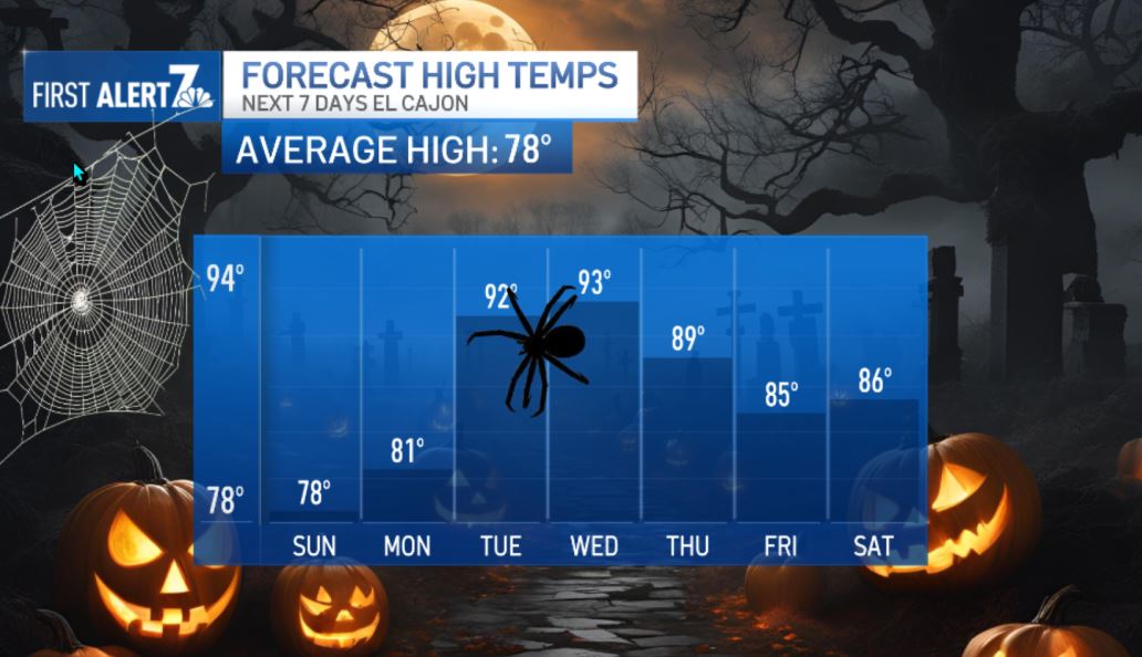
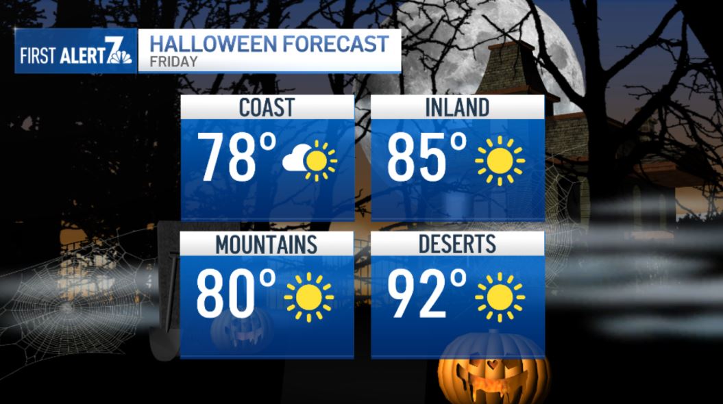
As we move into next week, high pressure will begin building over the West. That means a noticeable warm-up, with valley highs climbing close to the low 90s by Tuesday, Wednesday, and Thursday. It looks like it won’t be quite as hot by Halloween, with highs settling back into the 70s and 80s.

High pressure is going to heat us up this week! By Wednesday, the valleys could be almost as warm as the deserts with temperatures from the 80s to and low 90s.
The coast will stay close to the 70s this week, but downtown could reach the low 80s by Wednesday. Santa Ana winds are possible over LA, Ventura Counties this wee,k and it’s looking like easterly winds will be gusting around 35-45 mph Tuesday and Wednesday over our mountains. This will usher in warm, dry air into areas west of the mountains, which will elevate fire weather conditions.
That will be in addition to an already warm week with temperatures 5-15 degrees above average by mid-week.
SUNDAY:
- Coast: Mid-60s to low 70s, a.m. fog
- Inland: sunny – Low to upper 70s, mostly clear
- Mountains: Upper 60s to upper 70s, 25MPH W Gusts
- Deserts: Upper 80s to low 90s, 30MPH W Gusts