Nice Today, Wind and Rain Tomorrow
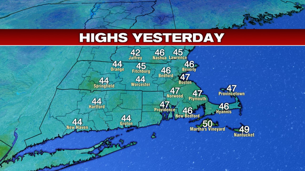
With temps well into the 40s yesterday, we finally got a chance to thaw out a bit as the numbers even went above average by a few degrees. That, despite a lot of clouds and a busy breeze.

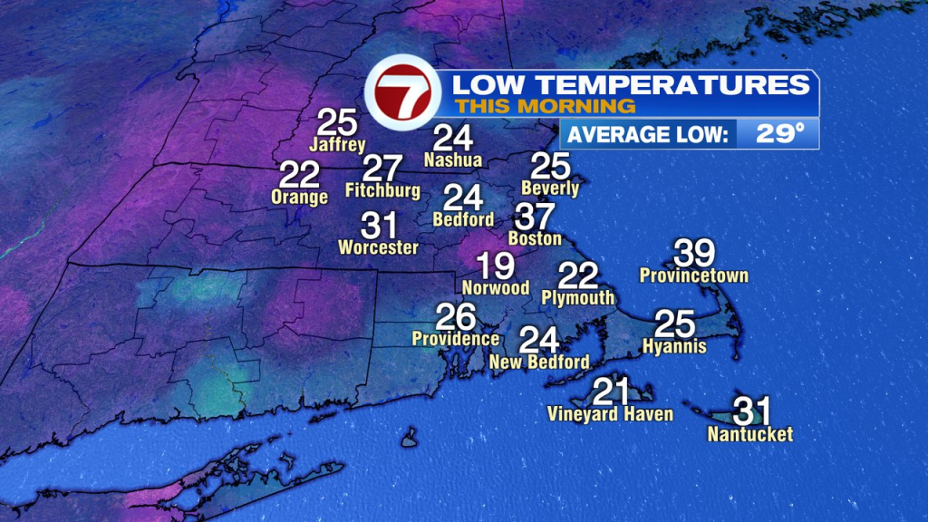
That breeze subsided overnight and skies cleared out, allowing for temps to drop off well below freezing. That means the snowmelt refroze, so watch for a few slick spots early this morning on the sidewalks and driveways.
Despite the early morning chill, temps jump up quickly today and head into the mid 40s to near 50. We’ll have more sunshine and lighter winds compared to yesterday, and that’ll allow for a nice December day overall.
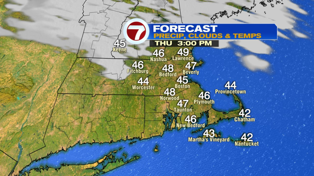
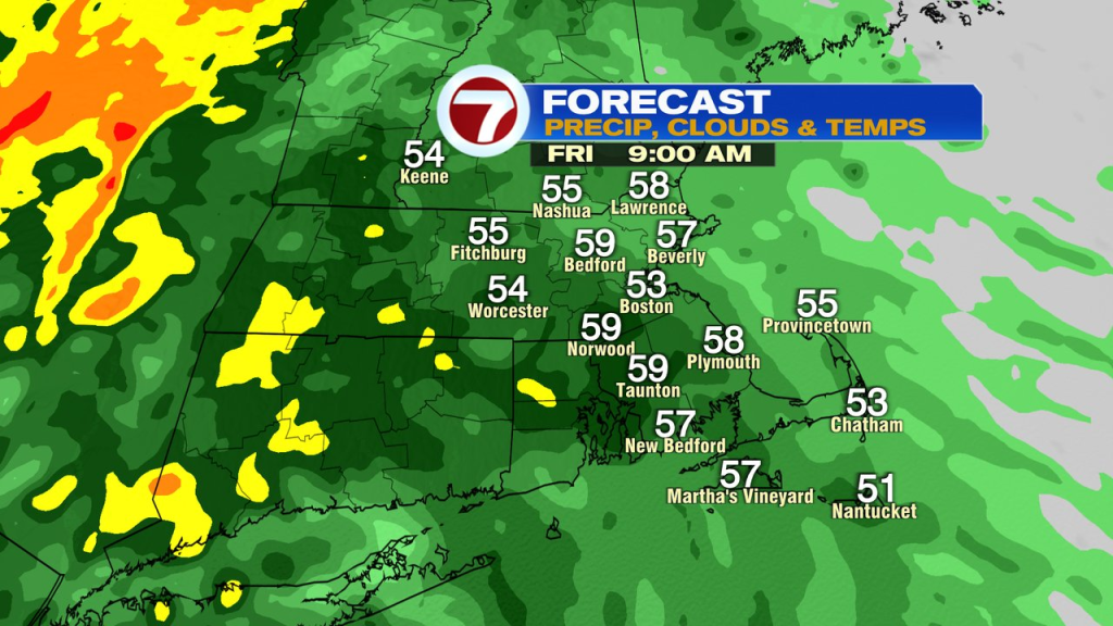
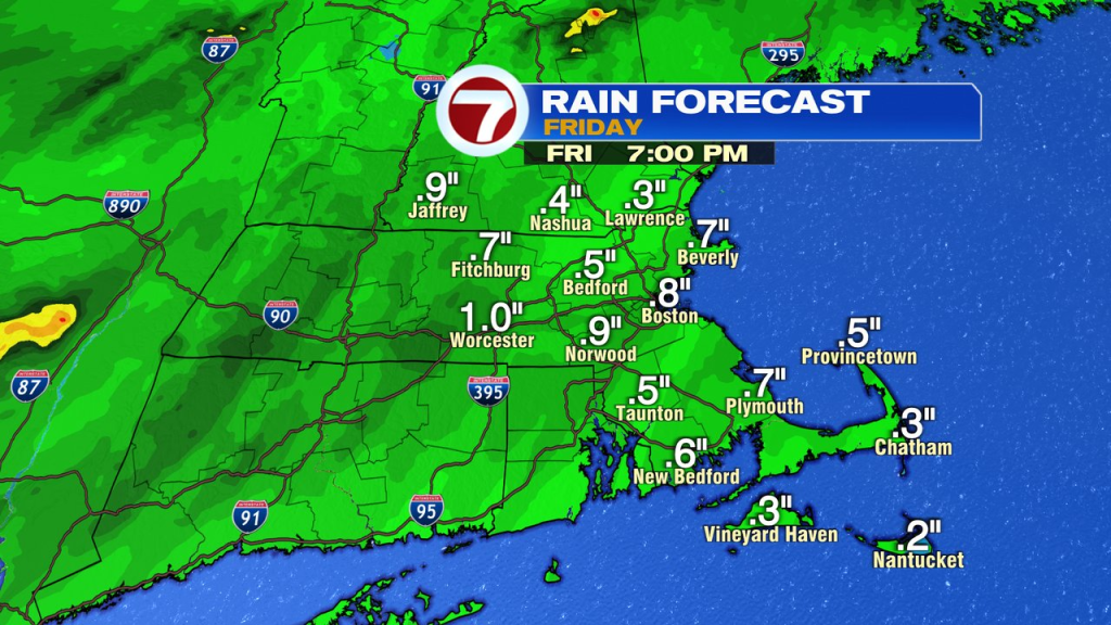
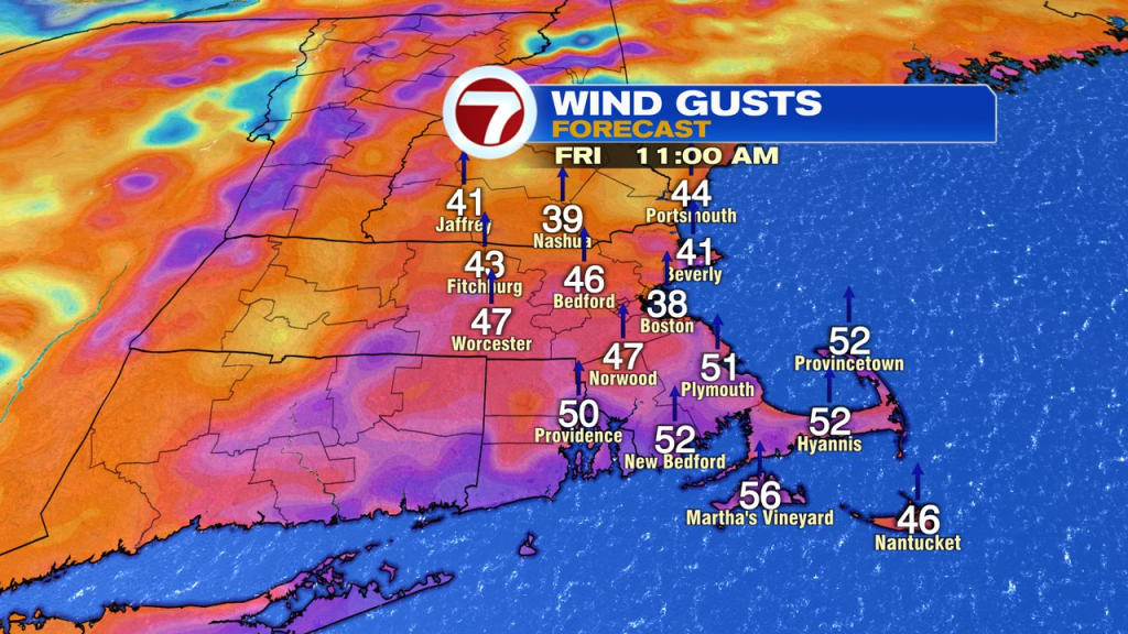
Temps slide into the 30s this evening, then go back up overnight tonight as clouds increase and scattered showers develop after midnight. By tomorrow morning, many of us are in the 50s as rain increases it’s coverage area mid morning, through early afternoon. That rain will be heavy at times as winds increase out of the south too. Gusts peak mid morning to early afternoon in the 40-60mph range, strongest across the Cape and Islands, where a high wind warning is in effect.
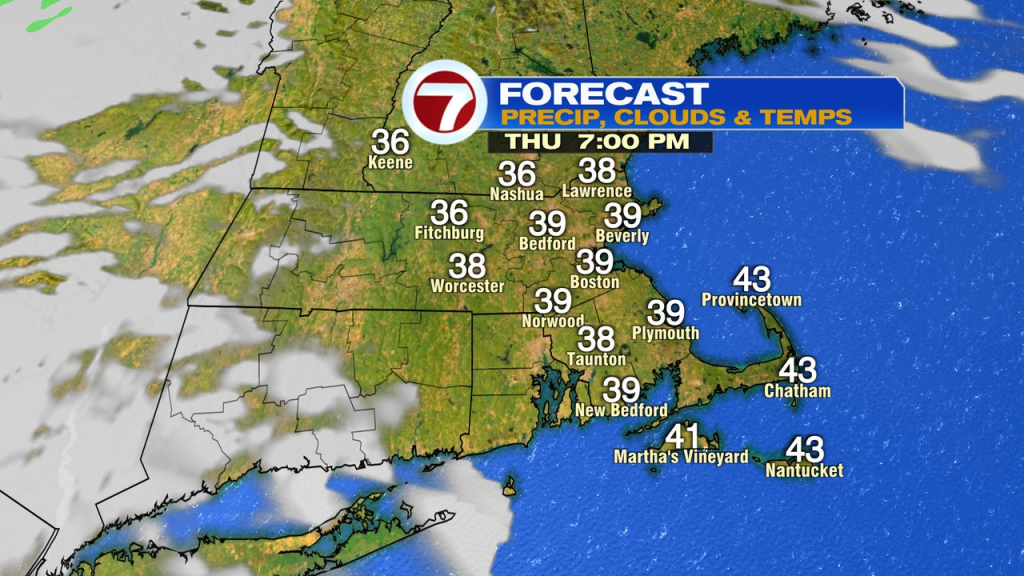
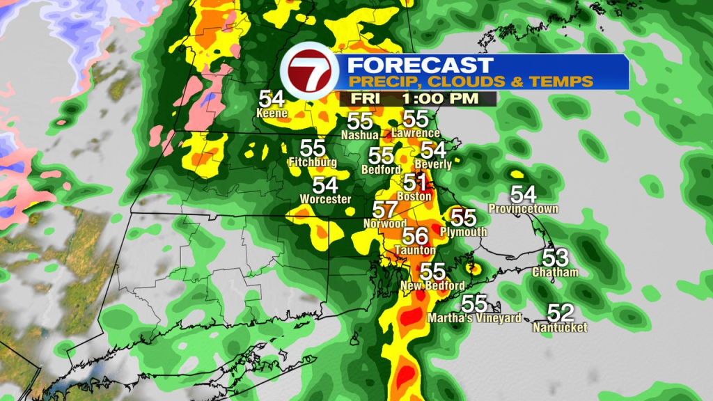
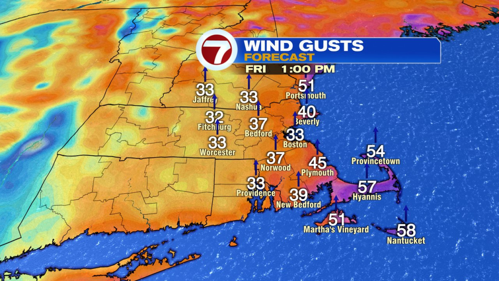
As the cold front moves through in the afternoon, temps will crash back from the 55-60 range to the 35-40 range from west to east. As we dry out tomorrow night, winds will gust out of the west 35-45mph.
A seasonable chill is back Saturday with some sun and just a spot shower is possible Sunday. Otherwise, the weekend is rather quiet for all those holiday errands you need to wrap up.


