Mild today, colder air to end the week
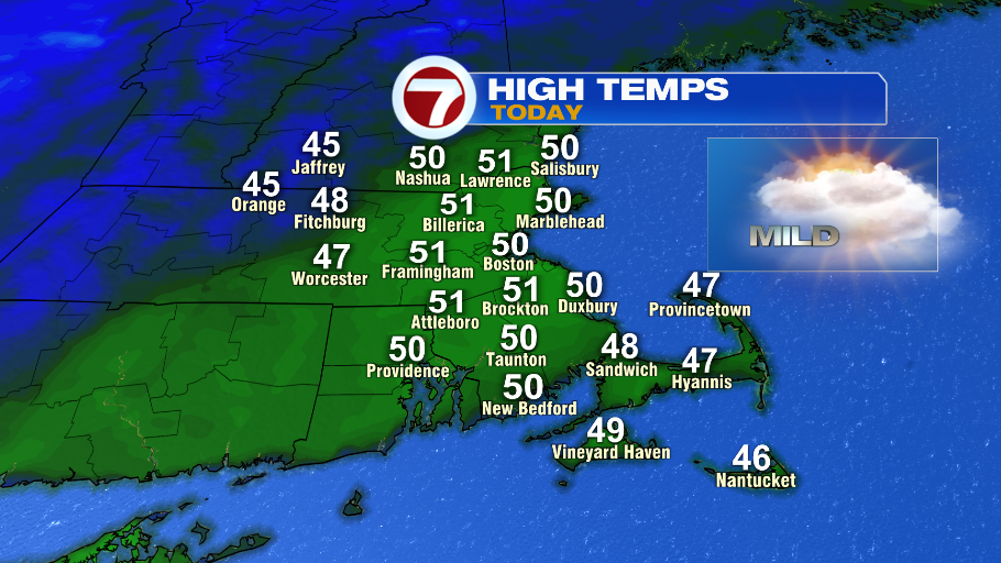
It’s a nice, mild start out the door this morning. We have temperatures now in the 40s and we’re on our way to 50° this afternoon. Our average high is now 37°. We’ll have a lot of clouds and a low risk of a spot shower (only like a 10% chance). So while not the brightest of days, it’s a good one to get outside and enjoy this little winter thaw.

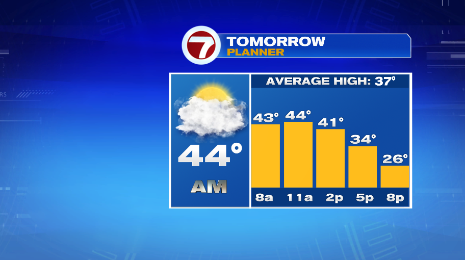
Tomorrow morning will have a similar feel to this morning, starting off in the 40s, but instead of climbing to 50° in the afternoon, we’ll head the other way as temperatures being to fall off in the afternoon. That’s the cold air returning to close out the week.
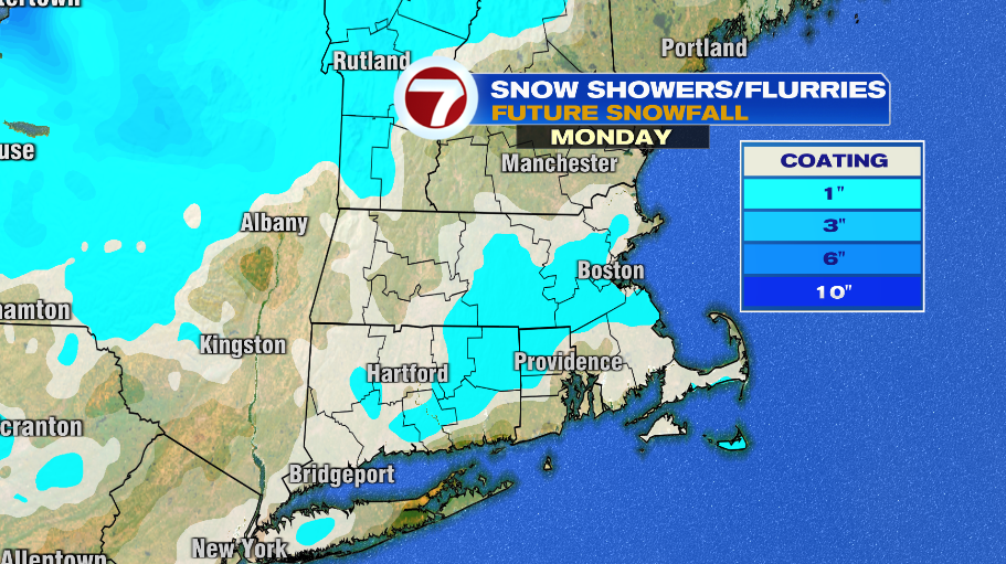
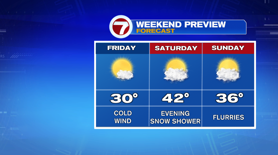
That cold air will take hold Friday with highs topping out near 30°, with the cold wind making it feel more like 20° on Friday afternoon. Thankfully the weekend is a little better. Actually, Saturday isn’t a bad day. We’ll have sunshine in the morning with increasing clouds in the afternoon. With the morning sun and highs in the lower 40s, that’s not a bad winter day. The increasing clouds are ahead of a few snow showers in the evening on Saturday. A few flurries will linger through Sunday and Monday of next week.
Over those three days COMBINED… Saturday, Sunday and Monday, we’ll maybe get an inch of snow in some spots. Nothing looks significant, but our best chance of a coating or so of those three days will probably come with Saturday evening’s batch. This isn’t an *official* snow map — it’s a little too far away for that, but it’s just one model’s takeaway of the three day snow totals. As you can see, it’s a coating to inch or so. More details on that as we inch closer to the weekend.