Major snowstorm, arctic blast to hit Philly region this weekend: What we know

The weekend is coming. Normally, something we look forward to, but this weekend, Mother Nature is going to send us a one-two punch: first, the cold, then a winter storm with the potential for significant snowfall.

Arctic blast arrives Friday
The setup begins Friday with a cold front that’ll usher in an arctic blast and bring us the coldest weather we’ve seen since last January. Morning temperatures in Philadelphia will drop to the lower teens, with even colder conditions in the suburbs and South Jersey. With the wind blowing, it will feel like zero on Saturday morning. We’re looking for a high temperature of only 20 degrees on Saturday afternoon.

Significant winter storm Sunday into Monday
So we’ve got the cold air moving in, and then here comes the storm on Sunday. Clouds will start spreading into the area on Saturday, but snow isn’t expected to develop in our area until around 10 p.m. Saturday night. But once it gets started, we’re in for some heavy snowfall that will continue well into the day on Sunday and potentially into Sunday night and Monday.
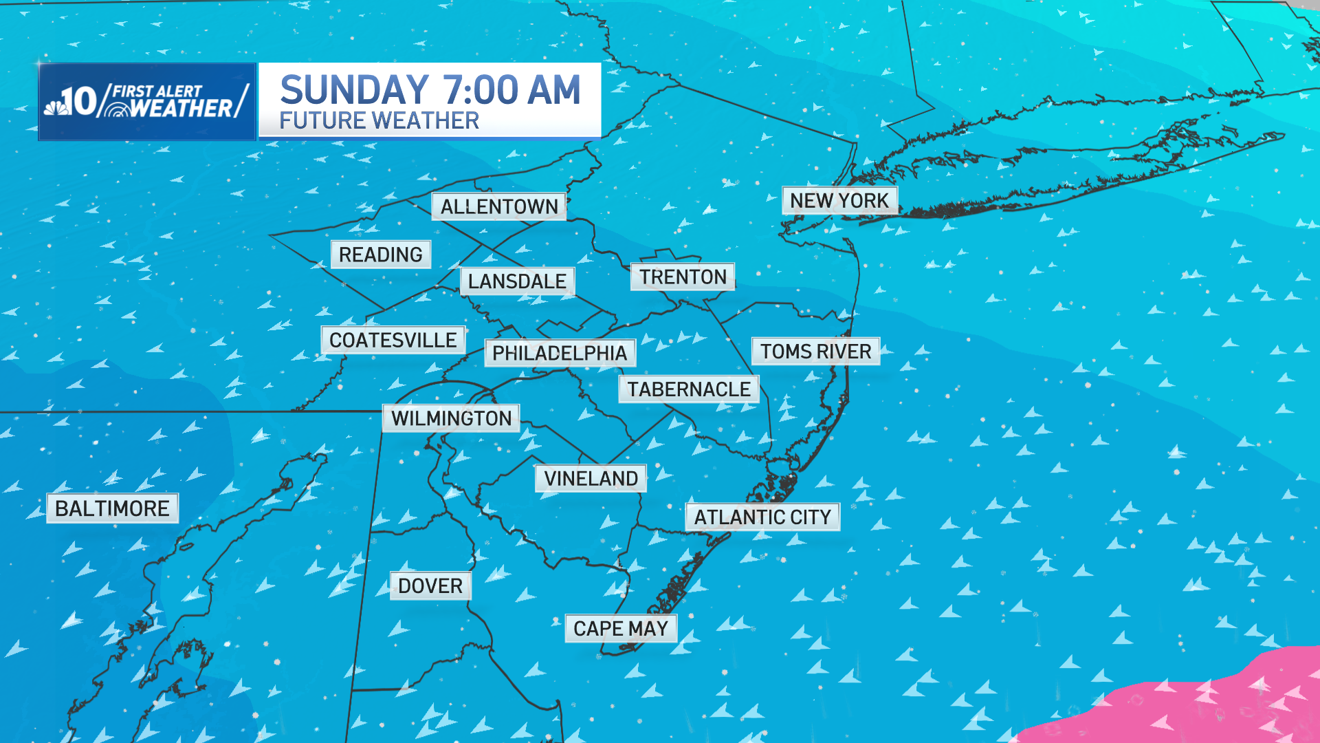
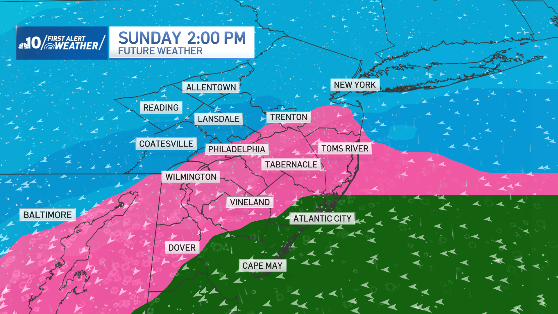
However, the system is now also trending farther north, allowing warmer air to puncture into the system. This means a wintry mix along and southeast of the I-95 corridor is becoming more likely for Sunday afternoon and evening. The system will taper off with a few snow showers around daybreak Monday.

Storm impacts expected
This is likely going to impact our area in a big way with travel trouble, not only in the air, but also on the ground. We’ll have plenty of shoveling to do, and anything that isn’t shoveled, plowed, or cleared will not be melting away as it will stay cold with high temperatures in the twenties through next week.
Snow totals and uncertainties
Right now, there is an 80 to 90% chance of 6 inches or more of snow from this system in our area. But realistically, given the data we’re watching now in the First Alert Weather Center, there is the potential for more than 12 inches of snow for parts of our area.

Time to prepare
With fine weather today, temperatures above freezing and plenty of sunshine tomorrow to warm us to near 50, and even dry conditions on Friday with cooler temperatures and a high of 40 degrees, this is an excellent time to start planning and getting ready for what you need to deal with the coming storm that will be moving through Sunday.
Be prepared for your day and week ahead. Sign up for our weather newsletter.
This story uses functionality that may not work in our app. Click here to open the story in your web browser.