Goodbye Dry & Watching the Caribbean
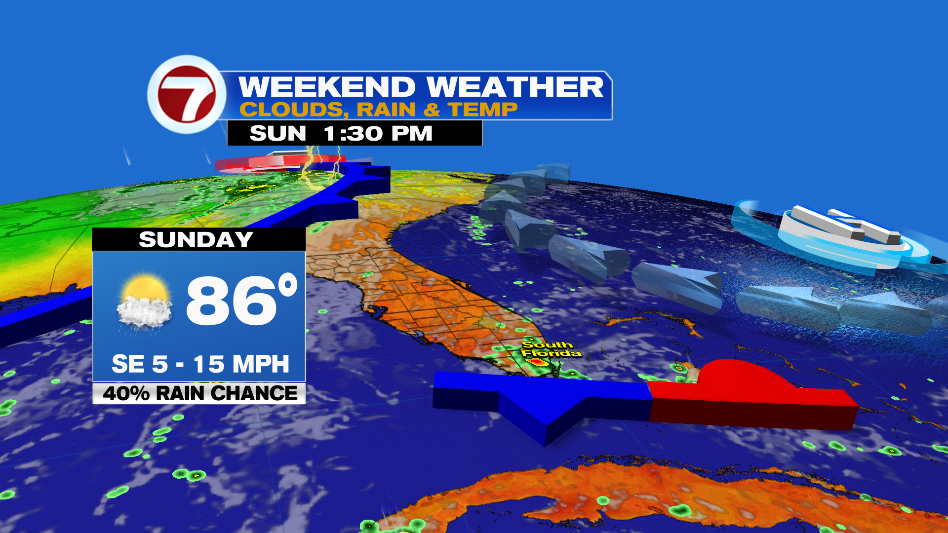
We hope you enjoyed the nice dry weather while it lasted! The big weather story today is the pattern change across South Florida as winds shift back from the southeast, bringing in higher humidity and rain chances.
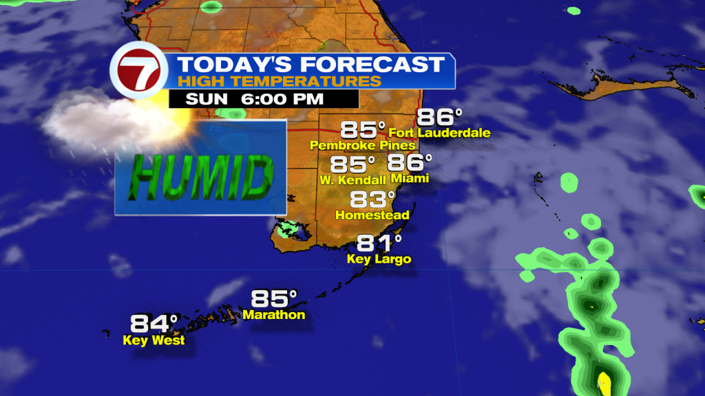
For your Sunday, expect a mix of sun and clouds with highs back in the mid-80s. There will be a humid breeze off the Atlantic, with scattered showers in the afternoon.
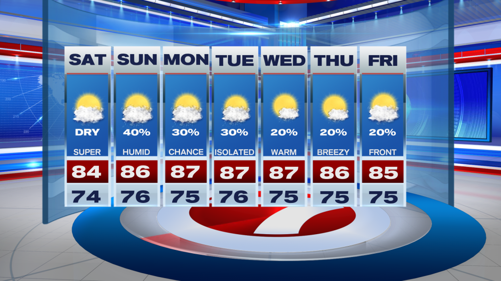
Looking ahead to the workweek, its much of the same with daily shower chances as a parade of weak fronts try to make their way down into Florida. Unfortunately, it doesn’t look like any of these will completely make their way through the state, which means more muggies and highs staying in the mid to upper 80s.
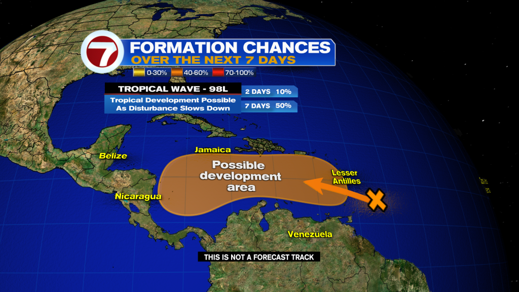
Tropical update
All eyes are on a strong tropical wave moving through the Windward Islands today.
The National Hurricane Center has labeled this tropical wave Invest 98L and now calls for a medium 50% chance of development over the next seven days.
98L is not expected to develop over the next couple of days due to dry air and wind shear, but will bring squally weather to the Windward Islands today. However, conditions look ripe for development once it reaches the climatologically favored western Caribbean late this week into next weekend. The untapped waters of the western Caribbean are warmer than average, wind shear looks relatively low, and the atmosphere looks moist. Interests in the Caribbean and anyone planning to vacation down there need to pay close attention to the progress of 98L. If it becomes a storm next name on the list is Melissa.