Florida freezes, but will it snow? The science behind this arctic chill

Florida is preparing for a notably cold weekend, with temperatures dropping into the 30s in some parts of South Florida, into the 20s across Central Florida, and even lower in the northern part of the state.
Given this outlook, many residents are asking the same question: Is there any chance we could see snow?
Based on the current forecast and available meteorological indicators, the probability of snow in Florida remains extremely low, especially outside the far northern areas of the state.
The arrival of cold air, even of Arctic origin, will bring bitter mornings and conditions that some areas have not experienced in more than 15 years, with daytime highs feeling unusually cool or even cold by Florida standards.
Overnight lows near or below freezing will be possible from Central Florida into parts of the Panhandle and North Florida. However, cold surface temperatures alone are not enough to produce snowfall. For precipitation to fall as snow, the entire atmosphere, not just the ground level, must be cold enough.
One of the most well-known methods for estimating the boundary between rain and snow is the so-called 540 line, a general rule of thumb used in meteorology.
This line is based on the atmospheric thickness between two pressure levels: 1000 millibars near the surface and 500 millibars around 18,000 feet (approximately 5,500 meters) above the ground. When that thickness is 5,400 meters or less, the air is typically cold enough to support snow. If the value is higher, precipitation is more likely to fall as rain.
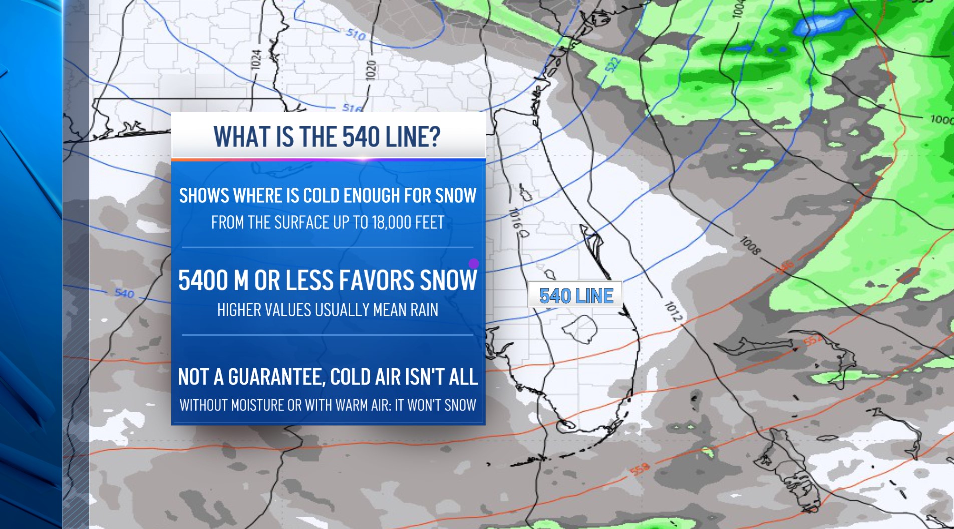
In simple terms, north of the 540 line the environment is more favorable for snow, while farther south, milder conditions usually mean rain.
In this case, analyses suggest the 540 line could dip as far south as the northern edge of Lake Okeechobee and remain in that area from Saturday night through early Monday morning.
However, the crucial factor, moisture or precipitation, is not expected to be present to allow snow to form. In other words, we may have the necessary cold, but we would be missing the main ingredient: water.
Even if cold air and water vapor were to combine, other factors still reduce the likelihood of seeing snow in Florida. A slightly warmer layer of air near the surface can melt snowflakes before they reach the ground, and significant snowfall also requires enough moisture and a well-organized storm system, something not expected to develop strongly this weekend, at least in our region.
Snow in Florida remains a historically rare phenomenon. While isolated episodes have been recorded in the northern part of the state during extreme Arctic outbreaks, these events are exceptional. For Central and Southern Florida, snow is virtually impossible under the current atmospheric pattern.
In conclusion, the weekend will bring a distinctly wintry feel, with intense cold and widespread frost expected across much of the Sunshine State. However, a widespread snowfall in Florida is not within the most likely meteorological scenario. Temperatures may drop, but snow requires a far more complex combination of atmospheric conditions.