Cool first day of June before 80s return
Happy Sunday everyone! While it wasn’t the perfect day…it sure was a whole lot better than yesterday. Thankfully, the forecast this week is looking pretty good!
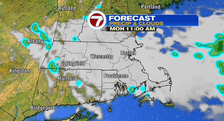
First, we’ve still got spotty showers and even downpours out there still, and those spotty rain chances do continue overnight. Sunday evening temperatures will cool to the 50s with overnight lows into Monday morning dropping to chilly levels in the mid 40s.
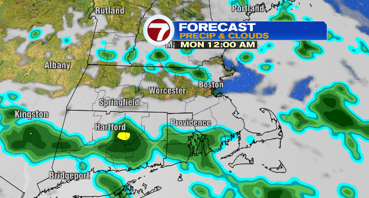
Skies will be mostly cloudy overnight, and a few isolated showers may linger as late as the early afternoon.
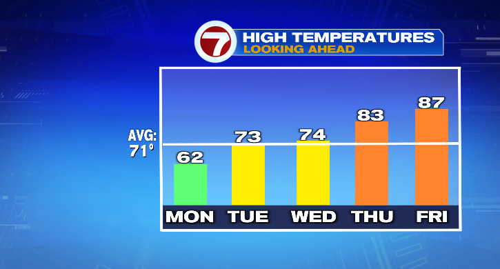
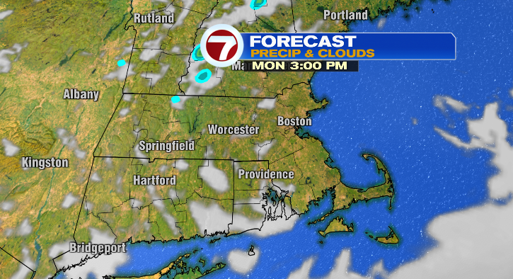
The rest of Monday looks brighter! Unfortunately, it won’t warm us much, we’ll only see highs in the low 60s.
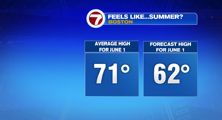
This time of year we typically see highs closer to the 70-degree mark, so that’s pretty cool for the first day of June! The good news? We’ll be warming right up after that.
Tuesday looks partly sunny with a low-end chance for a spot shower. Sure, we start the day in the 40s but we do make it into the low 70s for the afternoon. Wednesday: 50 in the morning to the mid 70s in the afternoon with bright skies and a breeze. Thursday, Friday and Saturday all look dry with some sun and warm temperatures into the 80s!
Next weekend we’re watching some rain chances. Saturday looks mostly dry in the 80s but we’re tracking rain chances overnight into Sunday. Stay tuned!